-
As Built.
IMANTOSIS team, provides As Built Surveys in any environment. When every detail in high accuracy, is needed, point cloud generation is used to measure and illustrate any shape a contemporary construction can form, from humble establishments to vast urban complexes.
2D technical and architectural drawings, 3D registered solid point clouds and photorealistic models, can be considered amongst the most common derivatives, embedded in any CAD base software, the client favors, or in intelligent GIS databases.
Rapid Reality Capture
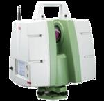
When both high accuracy and speed is required during the survey procedure, 3D terrestrial laser scanning overwhelms the traditional ways of measuring reality forms, that diverge from regularity.
Circular, bent and parabolic geometries, can be captured in a few minutes, with the visual and measurable point cloud product. The billion points that form the cloud, are the billion measurements in space, captured by the scanstations at the field of work, forming the three dimensional colored visual outcome.
Deformation Analysis
In the numerous structures an Engineer is involved, there are several structural challenges to confront. Challenges that turn up due to the complex and composite construction systems applied. Those applications most of the time come up with severe pathology, affected dynamically from the coexisting different systems such as concrete, steel and masonry.
The need to visualize and extract critical information from the variation of deformations, construction failures and from the diversion from the proper or expectant geometry, can be handled and managed, by the generation of a point cloud survey.
Hidden Structural Detail Extraction
In most case studies the elements that constitute a construction, may not be recognizable or measurable due to distance or the fact that they are formed from severable consecutive spaces, which may not be seen and examined at the same time.
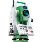
3D Scanning, with the aid of geodetic measurements if high accuracy is needed, brings all information and spaces together at the same time, in a solid registered point cloud, with all the detail, which can be seen, examined and processed at the office in any three dimensional visual environment.
Interior Design
3D Terrestrial Laser Scanning as a method, has many potential, concerning reality capture. It might be used not only for space documentation and measurement, but also for its equipment. Interior or exterior furniture, decoration elements and their layout, can be captured in every detail, decoding the client's needs and aesthetics.
Point Clouds from a 3D Terrestrial Scanner, form an irreplaceable asset for the designer to use, targeting to lead on an enhanced and optimal solution, throughout spatial visual design.
Application Regimentation
Among the countless applications of the 3D Scanning procedure, number the inspection of the design implementation. The Engineer or the Designer may control the development site, in real time, everyday, remotely from the office, even if his actual presence is miles away.
As a mighty control implement, focuses in the advancement of the installation, altering, modifying and amending the details to fit in the everyday changing construction site environment.
All Terrain 3D Scanning
IMANTOSIS team with its huge experience and the appropriate trained personnel, may provide services regardless the austerities and the harshness of the survey environment. IMANTOSIS three dimensional derivatives may refer to projects on and beneath the surface of earth, from quarries to mines, from tunnels to caverns and far more.


.jpg)

